Many people take the complexity of defining the route an aircraft should take to fly from point A to point B for granted. In the end, there are no roads in the air defining such a route, but the route is required to avoid crashing into other aircraft or getting into non-favorable weather conditions such as a storm. Therefore, aircraft navigation becomes an essential aspect of flying, whether a military or transport aircraft. So, let us take you through the details of such a vital aspect.
What is aircraft navigation?
Aircraft navigation or just air navigation refers to taking an aircraft from starting point to the desired destination while never losing control, getting lost, violating regulations governing aircraft operations, or putting people on board and the ground at risk.
The basic principles of general navigation (sea and ground) apply to aircraft navigation, including planning, recording, and controlling the movement of the aircraft in the air. And all this is achieved by using certain navigation aids to help the pilots know their exact location at all times.
The past
In the past, captains of the sailing ships in the early days relied on their navigator, a man in charge of marking a course from start to destination and determining the ship’s current location either on paper or a map by using complicated geometrical instruments and calculations. However, modern aircraft, especially military aircraft, fly at very high speeds that leave no place for such calculations.
Fortunately, technological developments have allowed aircraft to reach remote areas without any problem thanks to well-developed navigation methods. Let’s dive into the most common methods used for air navigation nowadays.
What are the main methods of air navigation?
Many people believe the most simple and useful method would be using a magnetic compass. However, a magnetic compass is only useful in a straight and level flight when it comes to flying. This said, the main methods of air navigation could be summarized in four. These methods are:
Pilotage
Dead reckoning
Radio navigation
Celestial navigation
Each of the methods in the list has a special way of applying it, and they can be combined for the best possible navigation depending on the situation. Let’s take a look at each method separately for a better understanding.
Pilotage
This is perhaps the most basic navigation method. Here the pilot uses visual references and the position relative to specific landmarks found on the ground. The references and landmarks the pilot will use while flying are established on the ground before takeoff and marked along the route on an aeronautical map. Common landmarks used include but are not limited to:
Rivers
Mountains
Buildings
Bridges
Of course, weather conditions such as strong winds may deviate the flight from the original route. The pilot can identify these deviations whenever the landmark is not found along the route, and corrections should be made.
Dead Reckoning
Dead reckoning is another basic method where navigation takes place based on time, speed, direction, and distance computations. These computations are adjusted for wind speed to get the real direction and ground speed. Checkpoints are established to verify the direction and ground speed are correct, making it possible to determine the arrival time to the destination.
This was a prevalent method in the early days of aviation. However, it has been discarded since it has a meager success rate because of wind direction and speed changes.
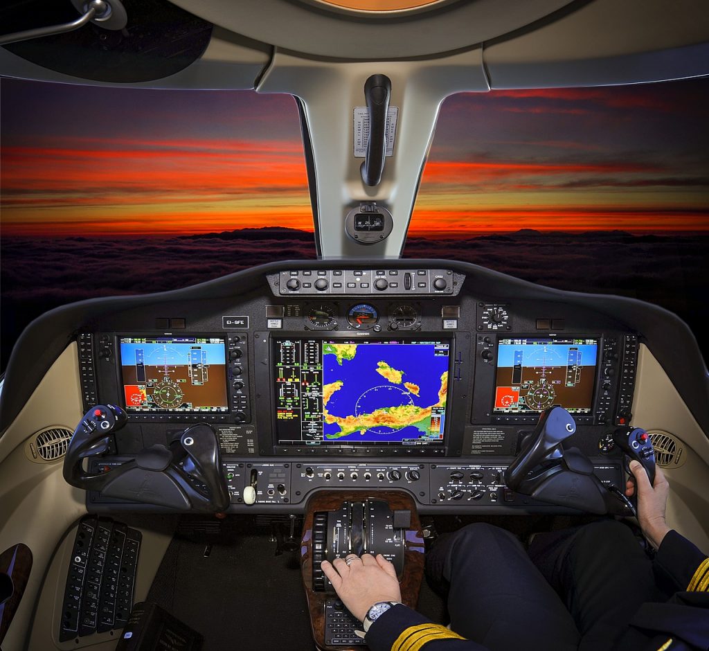
One of the most used methods is radio navigation. This navigation system allows the pilot to tune in to the right radio station, which is usually provided in navigation charts, and get the current position and course of flight in the navigation equipment installed in the aircraft.
The first global radio navigation system used was the one called OMEGA. It started operations in 1971, enabling aircraft to navigate using very low-frequency radio signals worldwide. Another system using land-based radio beacons was Loran-C, and it was also popular in the 1970s. However, a newer navigation system known as GPS made these two radio systems shut down in the 1990s. Nowadays a lot of information important to pilots is simply displayed on primary flight displays.
Celestial navigation
The general idea of celestial navigation is to use celestial prominent bodies such as the Sun, the Moon, planets, and stars as the primary means to determine position and direction.
A good example of the effectiveness of this navigation system is the SR-71 used a computerized celestial navigation system as one of its main navigation aids. The system could lock onto as many as 11 stars at a time, even during the day, and could determine the position of the jet with up to 300 feet of accuracy. Not bad at all for an aircraft reaching Mach 3.
While it is true that these are the most common and basic methods of air navigation, pilots can rely on other more specialized and sophisticated systems nowadays to navigate the world and ensure a safe flight.
For example, there are systems such as the Inertial Navigation System (INS), a completely self-contained system created for rockets that use motion sensors like accelerometers and gyroscopes to determine the plane’s position. There is also an autonomous system called Inertial Reference System (IRS), and the difference between INS and IRS is simply the source of data used to get positioning information the navigation system of an airplane.
However, the most popular method for flying nowadays is probably satellite navigation with the global positioning system or GPS. Let’s see what the GPS involves.
Global Positioning System (GPS)
Better known as GPS, this became a real global navigation system in 1994 when the 24th satellite was launched. This global navigation satellite system provides flight location and time information in all weather and climatic conditions, anywhere on or near the Earth where there is an unobstructed line of sight to four or more GPS satellites.
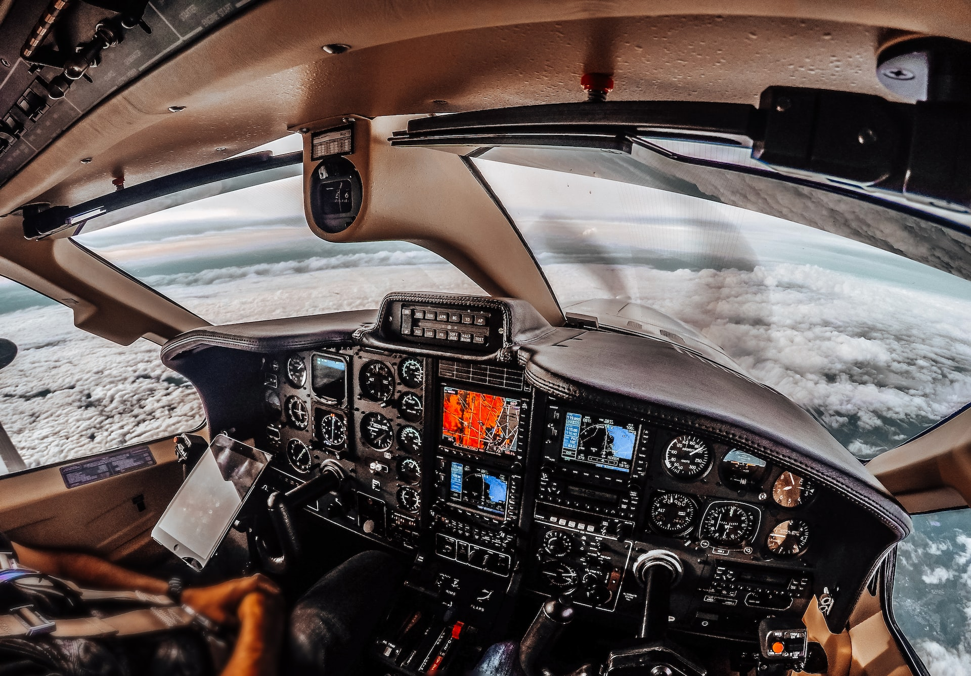
These capabilities make pilots the number one choice, especially those flying to remote areas or under Instrument Flying Rules (IFR), which have been defined by the Federal Aviation Administration (FAA). In the case of IFR flying, pilots will navigate their aircraft only using their cockpit instruments such as the airspeed and altitude indicates, which is why relying on a powerful tool such as the GPS is vital. GPS can be further supported by receiver autonomous integrity monitoring (RAIM) systems to ensure complete accuracy of navigational data during each critical stage of a flight.
ATC
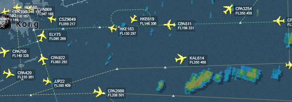
In addition to navigation systems available on an aircraft, air traffic control also plays a role in positioning and tracking flights.
ATC is especially important if when a pilot may not be aware of faulty navigational indications, and air traffic control systems may be the only possible means to detect unexpected aircraft positions.
However, to minimize ATC workload certain GPS anomalies or failures of unexpected aircraft systems should not be reported. The FAA usually prescribes standards to maintain air navigation facilities and distinguish the proper navigational aids.
Final words
Navigating in the air without any help would be a tough thing to do. Moreover, it is important to help keep pilots, crew, and passengers safe with rules such as having aircraft flying simultaneously to do it at different heights.
A modern aircraft navigation system consists of many different items such as distance measuring equipment, inertial navigation system, and magnetic field detectors. Usually, even light VFR aircraft are equipped with some navigation tools, but larger airliners require many more complex instruments and an instrument landing system.
Also, it is important to highlight that navigation is not limited to the air. Aircraft on the ground also use data from the equipment as well as any other possible reference to navigate while taxiing from the runway to the gate after landing or during other ground operations. Hence the importance of the systems that help pilots with navigating activities is immeasurable.
Want to read more like this?
Enter your email and get curated content straight to your inbox!
Thank your for your subscription.
You are already subscribed to this newsletter.
Aeroclass Team
A team of professionals with a deep passion for the aviation industry bringing you the newest and the most striking industry-related news and content.
Leave a comment
Recent posts
“Remove Before Flight” Tags on Aircraft
Aircraft · 6 min read
The superficial meaning of the words "Remove Before Flight" is "remove these tags before the plane takes to the air". What it really means is to remove all the protective covers and pins that protect against third-party objects before a flight.
Jun 19, 2024
How Fast do Planes Fly
Aircraft · 4 min read
Travel by plane became the main option for reaching the places people never dreamed of seeing long decades ago. Not just because we are talking about one of the main means of transportation capable of reaching places previously inaccessible - or challenging to reach - to most people.
May 31, 2024
Surging Aircraft Leasing Market Fuels High Demand for Expert Talents
Aircraft · 1 min read
The global aircraft leasing market, which has been on a steady rise for a number of years, is expected to surge to even greater heights in the coming decade. By 2029 the aircraft leasing market is estimated to reach the value of almost 300 billion USD.